OKM GEPARD GPR 3D
How it works
RADAR can be used to detect underground objects and structures such as foundations, cavities, bunkers and tunnels, but also pipes, septic tanks, statues and treasure chests

Optimization of underground analysis
Adjustable telescopic antennas facilitate the operation of the ground radar: Simply set the depth range and start the geophysical measurement.
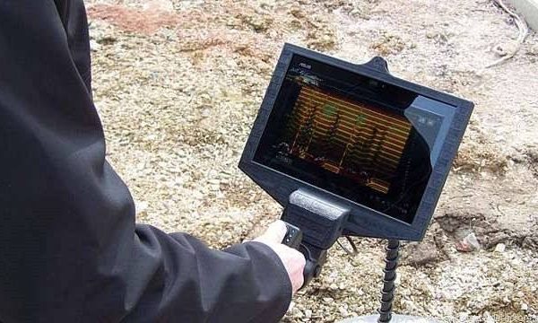
Measurement data analysis
The integrated Android software displays the measurement data immediately on the screen. Thanks to the integrated GPS support, all movement patterns can be saved together with the measured values.
The Gepard GPR is a very flexible, transportable and powerful Ground Penetrating Radar for the detection of underground objects like pipelines, cavities, cables, conduits, tunnels, bunkers and foundations.
The Gepard ground penetrating radar uses an omnidirectional unshielded transmission system to reach maximum depths up to 40 meters (131 ft). This light, agile and compact unit can be easily operated by a single user via Android Tablet PC.
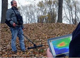
The RADAR (Radio Detection and Ranging)
of the Gepard GPR 3D sends a signal into the ground and awaits the reflection or echo of the signal to detect sub-surface anomalies.
Detectable objects and structures
underground walls, basements and concrete reinforcements
hidden cavities, graves and sepulchers
water level and underground rivers and aquifers
buried pipelines, conduits and cable harnesses
backfilled wells, galleries, trenches and dugouts
septic tanks, distribution boxes and drainage pipes
secret tunnels, bunkers and shelters
buried treasure chests, statues and caches
Feel Free To Contact Us